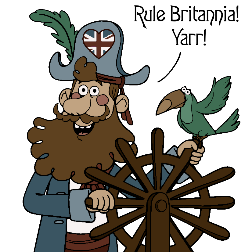
Artist’s interpretation of Captain Joshua Wayne during the American Revolution (1775 -1783) Pirate pirated from supersimple.com
Cabot Cove loved Captain Wayne as a colorful Yankee outlaw. Golden Age pirate lore is very popular in the United States, and an 18th century privateer like Captain Wayne would have been close enough to the real thing to inspire the collective imagination of a community.
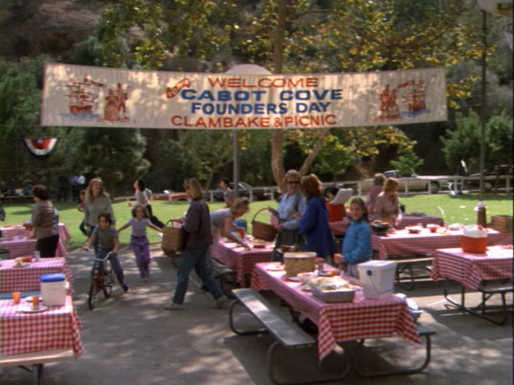
Cabot Cove’s annual Founders Day celebration (S1 E7: “Hit, Run and Homicide”) is a moment of reckoning for the community. Does Jessica tell the rest of Cabot Cove that Wayne fought as a loyalist during the American Revolutionary War? It appears this fact may have shipwrecked his legacy as a founding father. Cabot Cove moves on to other historical heroes later in the series.
Forty years ago, Cabot Cove was created to be an ordinary American small town. Its location on the coast of Maine endowed the Cove with enough plausible local color to distinguish it from other beloved places in T.V. Land. Throughout the MSW series, the denizens of Cabot Cove grappled with the limitations of the historical and cultural narratives that were integral to the community’s shared identity. In this way, Cabot Cove reflects the challenges that real communities, large and small, can face when cherished stories and beliefs do not stand up to historical scrutiny.
In other words, as we like to say here at MSWSW, fictional facts matter. While this post may strike you as a little uneven in tone, sometimes it’s important to be earnest. The stories we tell, whether intended to be historically accurate or pure fiction, are fundamental to how we perceive ourselves.
Land Acknowledgement
Purpose
A land acknowledgment is one way to recognize and honor the indigenous people who were the original inhabitants of a place to which you now belong. It is a way to call attention to the complex, uncomfortable heritage of colonialism and displacement that we all share. It is a beginning point, and a declaration of intention to continue to act in support of current day indigenous communities. If you are interested in learning more about land acknowledgements, the Smithsonian’s National Museum of the American Indian and the Native Governance Center both provide guidance.
Suitability
Here at MSWSW, we debated whether it was needful or appropriate to compose a land acknowledgment for Cabot Cove, especially because the geographic location of the town can be pinned down fairly specifically. Ultimately, we decided that, even with the best intentions, to make such a statement for a fictional place would be misguided. Instead, we would like to refer interested readers to the land acknowledgment made by the Boothbay Railway Village Museum, which is located in the same area of Maine.
Commitment
Acting in support of indigenous communities should not be limited to a single statement, to a single day (or month) on the calendar, or to a single blog post. The presence and influence of indigenous communities and cultures are interwoven and inseparable from the American identity, and, likewise, the very American television series Murder, She Wrote. Therefore, here at MSWSW, it is our intention to continue to highlight, celebrate, and reflect on the importance of indigenous people, communities, and cultures as we progress through our MSW journey.
Personal Note
Here at MSWSW, we (I) like to keep the focus on Murder, She Wrote. I’ve intentionally chosen to avoid personal details for many reasons. However, because this post clearly demonstrates my personal desire to recognize and honor indigenous communities and cultures, I want to note my personal connection to the Little Shell Chippewa, the tribe of my mother and my grandmother.
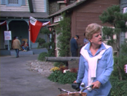
What’s more American than lots and lots of flags? Cabot Cove proudly displays quite a collection.
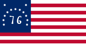
The Bennington Flag
The Bennington Flag originated during the American Revolutionary War, and has thirteen stars and stripes for the thirteen original colonies. The 76 refers to 1776, the year of the Declaration of Independence was signed. It’s colloquially known as the bicentennial flag, because it was a popular symbol during the United States’ Bicentennial in 1976.
The Bennington on Founders DayThe Bennington at Hill House
The Maine State Flag
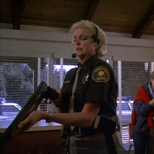
Maine State Flag at the Sheriff’s station
Also in the Founders Day picture above, to the right of the Bennington, is (probably) the Maine State Flag. Like a lot of other state flags, it’s the state’s coat of arms on a blue background, so it’s difficult to identify from a distance. Fortunately, we can see it more closely at the Sheriff’s station.
The Flag of New England
The Flag of New England and The Flag of Lincoln County, Maine in Cabot Cove
This is a variant of the unofficial Flag of New England, which, as a long time resident of New England, I don’t think I’ve ever seen in the field. It’s also the official flag of Lincoln County, Maine, which incidentally supports MSWSW’s hypothetical location of Cabot Cove.
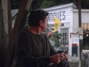
The Gadsden Flag
The Gadsden Flag in Cabot Cove
This is the Gadsden Flag, another flag from the American Revolution. This flag has long been associated with American libertarianism. More recently, it has been used as a symbol of the American alt-right.
In response to its adoption by the alt-right, numerous satirical variants of the Gadsden Flag have emerged, because, left, right, and center, Americans really love their flags.
“It is not down on any map; true places never are.”
Herman Melville, Moby-Dick
With apologies to Melville, I am going to attempt to locate the beloved, unreal-yet-true place of Cabot Cove on a map, using information gleaned from multiple episodes of Murder, She Wrote.
A Real Island
In the series premiere, “The Murder of Sherlock Holmes,” we are introduced to Cabot Cove as a small coastal town in Maine. The second episode of the series, “Deadly Lady,” is set in Cabot Cove. In this episode, we learn a bit more about where Cabot Cove is located based on it’s distance from a real place in Maine, Monhegan Island.
“Deadly Lady” opens in the middle of a hurricane. A yacht is stuck out in the storm, and the Coast Guard has picked up its distress signals. The next morning, when the yacht’s passengers are rescued and brought ashore in Cabot Cove, they explain that they were 3 miles due east of Monhegan Island. Although this story is later retracted, it is accepted as a plausible location.
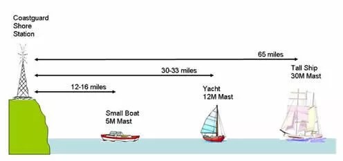
Watercraft use VHF (very high frequency) marine radio to communicate. The range of a VHF radio can vary due to a number of factors. Based on some cursory research, I found a good basic explanation here along with a handy diagram:
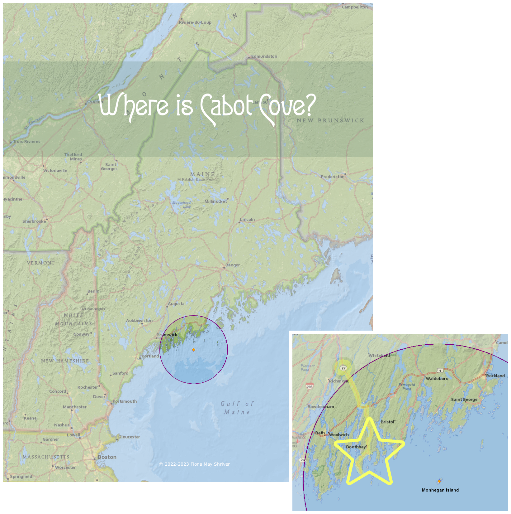
According to this diagram, we can estimate the maximum range of a VHS radio using a yacht height (12M) mast to be 30-33 miles. Therefore, we can place Cabot Cove within a 30 mile radius of Monhegan Island. This narrows the possible location of Cabot Cove to the circle shown on the map below:
There are at least two Coast Guard stations within this radius that would have been active in 1984, in Boothbay and Rockland. It stands to reason that Cabot Cove would be at least as close to Monhegan Island as either Coast Guard station for Captain Ethan Cragg to be called on as a first responder.
A Real Road
In S1 E7: “Hit, Run and Homicide” we learn more about Cabot Cove’s location relative to other real places in Maine. A key piece to the puzzle is Route 27. It’s referenced twice in the episode. It’s mentioned by Ethan Cragg as he discusses a search for a missing vehicle in Cabot Cove.
We also learn from Ethan’s statement that Cabot Cove is south of Augusta, which is consistent with the rest of the information we have so far. The portion of Route 27 that is within 30 miles of Monhegan Island is highlighted on the map above.
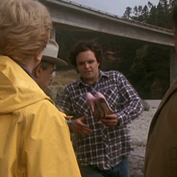
The other reference to Route 27 is easy to miss, but so crucial to locating Cabot Cove that it basically renders everything else, including the lovely map above, as pretty much moot. There is a scene between Ethan and a visitor to Cabot Cove, Dean Merrill, at the docks.
In the center background, beneath the speed limit sign, is the sign for the road immediately behind Merrill, Route 27. Again, in reference to the map above, the gold star represents the relatively limited area where Maine’s Route 27 runs along the coast.
A Real Cove?
That gold star narrows the location of Cabot Cove to Boothbay and Southport Island, the former being the larger and more likely spot. The area, similar to the rest of the ragged Maine coastline, is dotted with numerous coves and inlets. In the center of Boothbay Harbor is a small cove, Mill Cove. Until and unless there is evidence to the contrary, that is where the MSWSW search for Cabot Cove will come to rest.
Emma is one of Amos’ deputies in Cabot Cove. She is very conscientious about cleaning her firearms, but perhaps too lax when it comes to confidential information and PB&J’s, which might be why we do not see her again.